CMaps Plugin and GMaps Plugin customers now have additional control to name or assign license keys for tracking using our “department” field. This allows for an additional level of customization…
Read More


CMaps Plugin and GMaps Plugin customers now have additional control to name or assign license keys for tracking using our “department” field. This allows for an additional level of customization…
It is often that a state or country could be split up into multiple territories. Â If there is no specific hierarchy, or the general area is more important than a…
When using geographic boundary data (state, country, zip, etc), data could originate from one of many sources. ESRI Shapefiles is a format for exchanging data between various systems and as…
A centroid is a geometric center for a polygon. Centroids are typically used when you want to display a point / pin on the center of a polygon (shape). To…
Checklist to create your first mobile layer with your own data 1. You have downloaded CMaps Analytics App or GMaps Mobile to your iPad:Â DOWNLOAD NOW 2. You have logged in…
CMaps Analytics (formerly GMaps Mobile ) provides direct connectivity to basic Web Intelligence document report parts. Before connecting to any reports, you must define an SAP BusinessObjects Repository. Supported Versions…
Map Theme Name Custom map theme name is required to use custom themes. Binding your own name will allow your end users to select the theme. In addition, the theme…
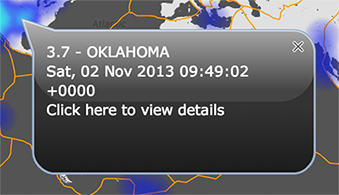
The following article is for CMaps Plugin for SAP Dashboards only. InfoWindows offer a series of appearance properties to change the appearance. “Show on” Options Info Window Display Options in…
Icon clustering groups any marker icons that overlap on top of each other. The purpose of icon clustering is to simplify a map interface and improve map performance. [ezcol_3quarter] When…
Data bound to the Values property is used to identify a measure with each data point, shape, or line segment within your map. The value property is displayed within the…