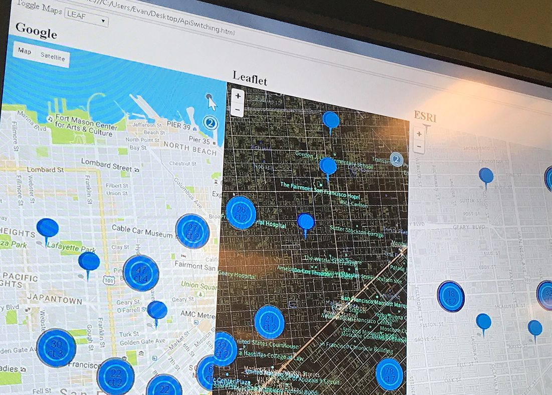
Bring your own Map Service From day one, we built CMaps Analytics to be maps agnostic. Now, we opening up the doors to not only support Google Maps Premium, but also MapBox, ESRI, HERE maps and Carto. Moving forward we can offer the best solution for your business needs and budgets. Our focus and value lies in simplifying interactive analysis, delivering a great end-user experience, and delivering insights through geospatial visualization. One consistent design and development experience for any maps provider is what you can expect from CMaps Analytics.
More reading abut this exciting new development

Region Geocoding
Goodbye Shapefiles and GeoJSON when all you need is common geographies!. With CMaps Analytics (cloud geocoder), you can load data into the map, define the geographic level, and CMaps Analytics will automatically display geographies you need including:- Countries
- Provinces
- Postal codes (USA & Canada),
- Counties (USA)
- Other geographies like US Congressional Districts, Metropolitan Areas, and more to come!
Realtime Region Creation and Buffer Layers
We keep tacking on new map layer visualization types that make maps easier. Merge / combine common geographies into custom regions in real-time is one of our top requests, so we have finally provided a new feature to accomplish the task. Additionally, you can use buffers around shapes and lines to visualize and constrain data in real-time.
Enhanced GIS and Location Analytics Integrations
For ESRI customers, CMaps Analytics ESRI integrations provides more control to select attributes, drill, and color elements. We also added polyline ESRI layers to round out our ESRI layers. For customers who are all-in on ESRI, you now have the perfect toolkit to interact with ESRI data. Carto is one of our favorite Location Analytics platforms, so we have continued to strengthen our integration to re-use your Carto investments inside of CMaps Analytics integrations and extensions.
Improved CMaps Designer Workflows
CMaps Designer is getting some minor updates to simplify creating and configuring data in your maps. Our data configuration tab is getting a facelift, and we are exposing more CMaps Analytics API features for point and click configuration.
See CMaps Analytics in Action
 ]]>
]]>