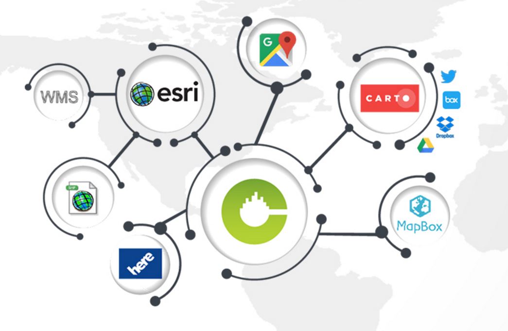
CMaps Analytics, our journey becoming a Location Intelligence company started with building maps extensions using a wide range of cloud maps APIs. Over the last 5 years, we have licensed APIs from Google Maps, TomTom, MapBox, integrated powerful Location Analytics engines like ESRI and Carto, and designed plug and play integrations for SAP BusinessObjects and MSFT.
Bring your Own Web Maps
Now, with one consistent CMaps Analytics approach you can integrate any web maps services like Google Maps, HERE, MapBox with GIS / analytics from ESRI or Carto you can invest / divest in any web maps solution without changing your end user experience. At CMaps Analytics, we view ourselves as an accelerant to help reach the finish line faster. We built over 20 map layer types and hundreds of configurable options, and geospatial analysis widgets that empower non-geospatial experts to create maps. For developers, we have created a highly configurable JS API that serves as an ultimate toolkit to embed Location Intelligence into your business applications.Function over Base Maps
There are hundreds of tools to create maps and view geographic data on the internet. We believe that the key to your Location Intelligence success and adoption relies on your organization’s ability to use analytics, interactive analysis, and visualization in harmony. It takes competencies in these three areas, along with having the right business and spatial data. If your organization is still grappling with these three, we recommend taking our online assessment.