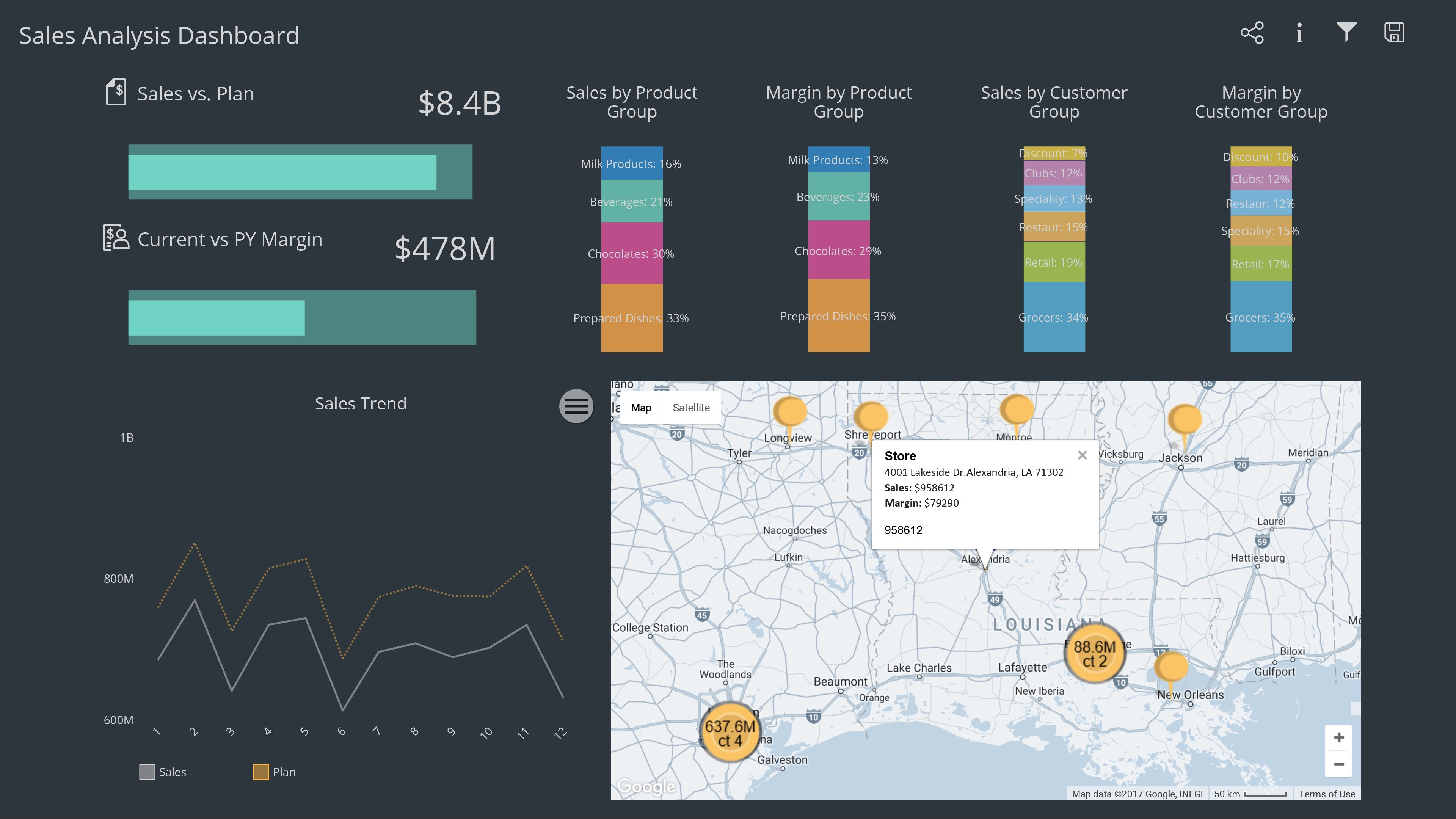
GeospatialPLUS, created by Archius, which can be installed inside of SAP BusinessObjects Design Studio and Lumira 2.0. In this demo, you can see how data driven maps by US Zipcode can be configured within a minute of loading data. [su_youtube url="https://www.youtube.com/watch?v=ZVY7skG0CU4&feature=youtu.be"] Archius has taken a formula that made CMaps Plugin a hit and pushed the needle forward so customers can benefit from data driven maps.
Why Choose GeospatialPLUS?
 GeospatialPLUS is a brand new combined solution, but it is built with CMapsAnalytics API version 4, and on top of an already successful ChartsPLUS solution that Archius has matured over the years. Archius brings to the table years of experience implementing real-world dashboards with DesignStudio and deep technical knowledge building premium add-on solutions. Customers who use GeospatialPLUS get access to Archius competency center for Dashboard execution and CMaps Analytics resources for Location Intelligence.