[ezcol_2third]
Dynamic Zoom
Enabled Dynamic Zoom
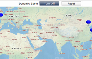
When Dynamic Zoom is enabled, CMaps Plugin and GMaps Plugin will automatically pan and zoom as to fit all points into the maps interface. When Dynamic Zoom is enabled, only an end-user can change the pan-to location or zoom level by interacting with the map.
NOTE ON SHAPEDATA: Dynamic zoom is not compatible with shpaedata and will require a developer to manually define a pan-to location and zoom level.
Disabled Dynamic Zoom
When Dynamic Zoom is disabled, the Zoom and Pan to Location properties must be set. Bind a single cell or manually enter a numerical value from 0-20 to dynamically control the map’s zoom level. When using the zoom property, only whole values will are compatible. Zoom is only executed when the Dynamic Zoom Properties disabled.
A change to the zoom property during SWF runtime will trigger the map to zoom and focus the map.
[/ezcol_2third] [ezcol_1third_end]
Define alerts logic through the alerts tab or manually via color binding.[/ezcol_1third_end]
Dynamic Zoom Toggle (available with CMaps Plugin 4 only)
Bindable property that will disable/ enable the map from automatically setting the pan-to and zoom level properties based on the data in your dashboard. Bind this property to a single cell. The contents of the cell must equal 1 (dynamic zoom on) OR 0 (dynamic zoom off).
Zoom Property
Bind a single cell or manually enter a numerical value from 0-20 to dynamically control the map’s zoom level. When using the zoom property, only whole values will are compatible. Zoom is only executed when the Dynamic Zoom property is disabled.
A change to the zoom property during SWF runtime will trigger the map to zoom and focus the map.
Pan-To Property
Bind a single cell that contains an address or [Latitude,Longitude] value to control the map’s pan-to location. CMaps Plugin will center itself on the Pan to Location anytime the cell value changes.
Note for CMaps Plugin: When using CMaps Plugin geocoder to define “Pan To” location, administrative areas like country, or state will center on the capital and not the center (centroid) of that administrative area.


