Learn the basics for working and layering series to create the most common mapping experiences for your customers. VIDEO:Â Learn how to create this dashboard DOWNLOAD GMaps Plugin Template NOTICE: This…


Learn the basics for working and layering series to create the most common mapping experiences for your customers. VIDEO:Â Learn how to create this dashboard DOWNLOAD GMaps Plugin Template NOTICE: This…
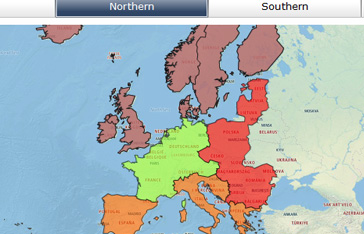
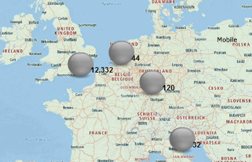
Use multiple shapefile layers including a custom regions and countries in europe. Combine shapefiles and standard SAP Dashboards selector filtered rows to drill. DOWNLOAD- Login Required
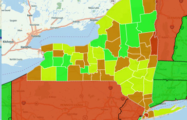
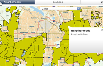
Use multiple shapefile layers and create interactivity, allowing a business user to drill from state to county level metrics. DOWNLOAD- Login Required
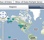
Merge standard selector to visually filter locations within a map by a single dimension. DOWNLOAD CMaps Plugin Template
Display text values from the “Values” property directly on top of the map using the Labels Icon type. DOWNLOAD CMaps Plugin Template
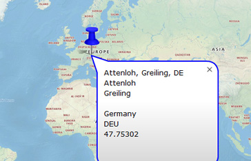
Transform latitude, longitude data into human readable address data using the new reverse geocode feature. DOWNLOAD DASHBOARD
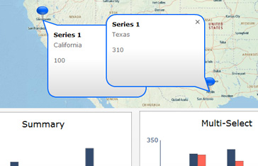
Enable users to select multiple points within the map using the multi-select feature. Â DOWNLOAD CMaps Plugin Template In addition to toggling multi-selection, there is also an ad-hoc panel for enabling…
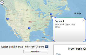
Dynamically select a location within the map using external SAP Dashboards components or Excel logic. DOWNLOAD CMaps Plugin Template
Learn the basics for importing a shapefile into CMaps Plugin and how to navigate multiple geographic grains of data. DOWNLOAD CMaps Plugin Template
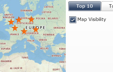
Dynamically show / hide layers within the map using series visibility. DOWNLOAD CMaps Plugin Template