

-
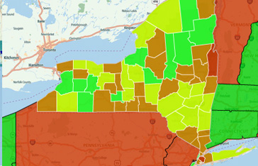
Drill from State to County with Shapefile Keys
Use the selection of one shapefile layer to filter details for a second using Shapefile key properties.
-
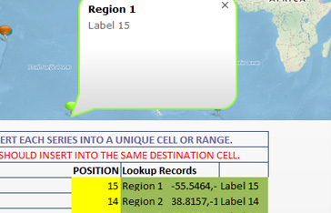
Multi Series Selection
Learn how to format labels using standard text or HTML, with embedded images and URLs.
-
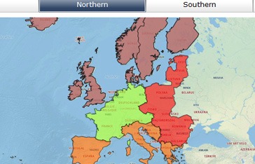
Shapefile Filtering
Filter shapefiles using Shapefile key and data key properties
-
Drawing and coloring lines
Use the polyline feature to draw lines or multi point segments.
-
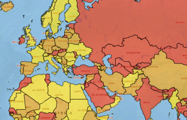
World Heatmap
Color countries using alert or heatmap logic driven from Excel
-
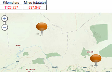
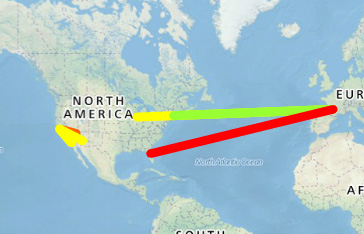
Distance Calculation
Dynamically calculate the distance between two or more locations on a map.