

[ezcol_2third]
$(this).attr('rel', $(this).data('rel'));
});
$("a[rel^='prettyPhoto
[gallery1]
']").prettyPhoto({
animation_speed: 'fast',
slideshow: 5000,
autoplay_slideshow: false,
opacity: 0.80,
show_title: false,
theme: 'pp_default', /* light_rounded / dark_rounded / light_square / dark_square / facebook */
overlay_gallery: false,
social_tools: false,
changepicturecallback: function(){
var $pp = $('.pp_default');
if( parseInt( $pp.css('left') )
[/ezcol_2third] [ezcol_1third_end]
Basic CMaps Plugin / GMaps Plugin
[post_list name=”postExcerptDivided_5_Templates”]Advanced CMaps Plugin / GMaps Plugin
The following templates require you to be logged-in as a partner or Centigon Guru
// // // // <![CDATA[ $(document).ready(function() { $('a[data-rel]').each(function() {$(this).attr('rel', $(this).data('rel'));
});
$("a[rel^='prettyPhoto
[gallery1]
']").prettyPhoto({
animation_speed: 'fast',
slideshow: 5000,
autoplay_slideshow: false,
opacity: 0.80,
show_title: false,
theme: 'pp_default', /* light_rounded / dark_rounded / light_square / dark_square / facebook */
overlay_gallery: false,
social_tools: false,
changepicturecallback: function(){
var $pp = $('.pp_default');
if( parseInt( $pp.css('left') )
-
View View Download
Drill from State to County with Shapefile Keys
Use the selection of one shapefile layer to filter details for a second using Shapefile key properties. -
View View Download
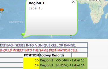
Multi Series Selection
Learn how to format labels using standard text or HTML, with embedded images and URLs. -
View View Download
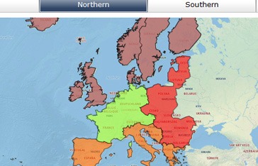
Shapefile Filtering
Filter shapefiles using Shapefile key and data key properties -
View View Download
Drawing and coloring lines
Use the polyline feature to draw lines or multi point segments. -
View View Download
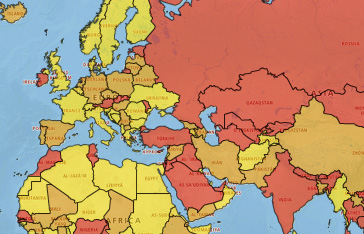
World Heatmap
Color countries using alert or heatmap logic driven from Excel -
View View Download
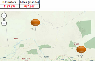
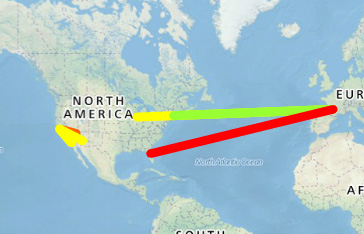
Distance Calculation
Dynamically calculate the distance between two or more locations on a map.